Quantcast


Mountain Biking & Forest Bike Trails in Maine


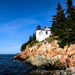
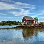
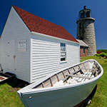
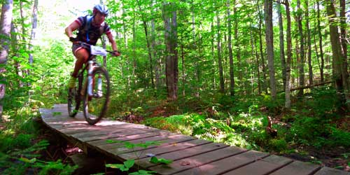
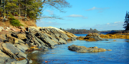
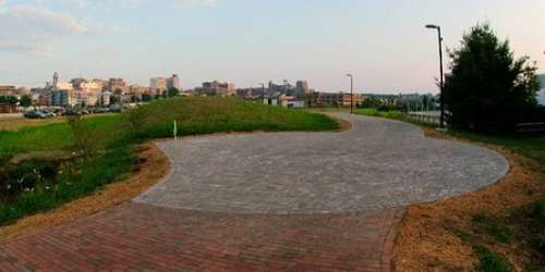
Biking in Maine, whether on the roads or on wooded trails, is a great sport done in beautiful surroundings. Head up to Bar Harbor to bike through Acadia National Park, or down from Kittery toward Floria along the East Coast Greenway. Trails are plentiful, people are friendly, and you can see much more of this incredible state than you would from out a car window. [Photo thanks to John Matrix and Bike List]

Biking & Bike Trails in Maine
Carriage Roads of Acadia National Park Bar Harbor Maine
Biking in Acadia National Park

Total Length: 45 Miles

Acadia National Park has about 45 miles of roads for bicycling, but much of that mileage is road shared with autos and walkers, so caution is essential. The 27-mile long Park Loop Road connects many locations in the park, include Sand Beach, thunder Hole, Gorham Mountain. Part of the road, beginning near the Route 233 entrance to Cadillac Mountain in Bar Harbor, is one-way. The rest of the loop road is two-way. The famous carriage roads in the park also are shared with car and walkers. See maps for numerous access points.
The park’s Summit Road, to the top of Cadillac Mountain, is recommended only for very fit and experienced bike riders.
Bike rental shops. Park road maps and alerts.
down east sunrise trail
Down East Sunrise Trail

old railroad bed Washington Junction to Ayers Junction, ME Phone:

Length: 87 miles in three sections

The Down East Sunrise Trail is the longest off-road portion of the East Coast Greenway, which runs from Maine to Florida. Down East Sunrise Trail is open to bicycles, walkers, horseback riderss, cross-country skiers, ATV riders, snowmobilers and dog sledders. It is located on an rail corridor and is open in all seasons; accessibility depends on weather conditions.
The Downeast Sunrise Trail passes through the woods, marshlands, and coastal villages of Hancock and Washington counties. It consists of the Eastern, Central or Western segments. These segments are from Washington Junction to Cherryfield; Cherryfield to Machias; and Machias to Ayers Junction
Trail map.
saco bike tour
Saco River Bike Tour with ExploreMaine

see trail map Old Orchard Beach area, ME Phone:

This tour is comprised of two loops that begin and end in Old Orchard Beach and include lots of views of beaches and ocean waters, with views of farmland in the interior portions of the ride. You will see the pier at Old Orchard Beach; Ferry Beach; Saco River views; the old mill in the village of Goodwins Mills. You may see signs in English and French since this area is a favorite vacation spot for many French Canadians. Ferry Beach State Park is a nice waterfront stop along the journey.
The 27- mile loop has gentle terrain and is fine for most riders. The 48-mile loop has moderately hilly terrain, best for intermediate cyclists.
Starting point: The rides originate from the Old Orchard Beach High School parking lot. Map of starting point. [ Photo courtesty Dave Maher and Maine DOT]
wolfs neck state park ME
Freeport and Brunswick Bike Tours by ExploreMaine

see trail map Freeport and Brunswick, ME Phone:

This tour includes four loops ranging in length from 9 to 33 miles. Terrain is gentle slopes or hilly. Difficulty levels are almost anyone to moderate ability. The 9-mile loop takes you out to Wolfe’s Neck Woods State Park with views of the coast. The 16-mile loop explores the back roads of Freeport and passes Maine Audubon Mast Landing Sanctuary. The 18- and 33-mile loops take cyclists past beautiful scenery of Freeport and Brunswick. See link at ride title to access bike tour maps and brochure with directions.
Trailhead: All rides start at Leon Gorman Park on Bow Street. - Map of the Park
eastern promenade trail
Eastern Promenade Trail

Length: 2.1 miles

Eastern Promenade Trail moves along the shoreline of Casco Bay and Portland Harbor in Portland and water views are continuous during a ride on this trail. The trail runs through Eastern Promenade, which is on the seaward side of Munjoy Hill. This paved trail is open for use by pedestrians, bicyclists, and skaters.
The Eastern Promenade Trail starts at the Bayside Trail, which connects with the Back Cove Trail that encircles Back Cove. The bike and foot trail passes a wastewater treatment plant, crosses a parking lot at Cutter Street, and then proceeds past East End Beach and Fish Point. The trail ends at the ferry terminals, where boats depart for offshore islands. Trail map.
Trail Access: Sewage Plant Road near I-295/Bayside Trail and Maine State Pier at Franklin Street/US 1A and Commercial Street in Portland. There is an access point at Cutter Street.
Maine Mountain Division Trail

Length: One 6-mile piece in Standish and another 4-mile piece in Fryeburg

Plans call for the Mountain Division Trail to ultimately cover 52 miles between Fryeburg and Portland. Two sections of the trail are open now. A 6-mile segment between Standish and South Windham provides a gently rolling ride in the Sebago Lake watershed area, northwest of Portland. The second leg, in Fryeburg, begins not far from the Maine–New Hampshire border and travels 4 miles along the railroad right-of-way.
Access: To get onto the southern segment, start from the western trailhead at Johnson Field in Standish. To get onto the shorter northern segment, start from the Maine State Visitor Information Center at 97 Main Street in Fryeburg. The paved trail ends near the small regional airport and the Brownfield town line. Consult trail map.
Trail map.
East Coast Greenway in Maine

Total Length: 80 Miles

The National East Coast Greenway is a 3,000-mile biking trail connecting Calais, Maine, to Key West, Florida. The greenway route in Maine is about 400 miles. Here are some of the greeway loops. All rides below are described as moderate to difficult, for intermediate and experienced cyclists.
Eastern Trail from Kittery to South Portland. 68 miles. The Eastern Trail connects Bug Light Park in South Portland with Strawbery Banke in Portsmouth, NH.
Casco Bay from South Portland to Brunswick. 35 miles. This pleasant ride takes cyclists from Portland’s waterfront to nearby suburban towns, including Falmouth, Yarmouth, Freeport and Brunswick, and the Maine coastline.
Details of trails .
Kennebeck River Rail Trail - From Augusta to Gardiner, ME
Kennebec River Rail Trail

Along the Kennebec River Augusta, Hallowell, Farmingdale, and Gardiner, ME Phone:

The Kennebec River Rail Trail runs adjacent to the railroad bed along the Kennebeck River. It is 6.5 miles long and it is open for walking, running, bicycling, skateboarding, rollerblading, and dog walking. The terminal points of the trail are Waterfront Park in Augusta and the city of Gardiner. The trail passes through the towns of Hallowell and Farmingdale. Portable restrooms are under Memorial bridge and at the Capital connector in Augusta; in the municipal parking lot in Hallowell. - Access Points & Parking Locations
Bayside Trail - Portland, ME
Bayside Trail

Trailheads at Elm Street and Casco Bay end of Marginal Way Portland, ME, 04101 Phone:

This 1-mile trail is a flat, paved surface through the Bayside and East Bayside neighborhoods. It extends at the south end from Elm Street between Somerset Street and Marginal Way and parallels Marginal Way, linking with the East Promenade and the Back Cove Trails near the highway overpass where Route 1 crosses Back Cove. There are several benches and three water fountains. Trail is good for walkers, runners, and bicyclists.
Royal River Park - Yarmouth, ME
Royal River Park

111 East Main Street Yarmouth, ME, 04096 Phone:

A 1.3-mile paved path extends through the park along the river and runs parallel to Yarmouth village. This popular park for walkers and bikers passes waterfalls, a forest, open fields, and a hemlock grove. Picnic tables available. Biking is allowed on the path. Dogs on leash are allowed.
Directions: The main entrance and parking lot is across East Elm Street from the Yarmouth History Center, just east of the Main Street intersection. There are more entrances from Mill Street, the Beth Condon Pathway near the Rowe School, the entrance of Forest Falls Drive, and from Bridge Street.